The Five Passes route in Mount Aspiring National Park is one of New Zealand’s classic wilderness tramping routes – around 67 km of rugged and demanding terrain, with no huts or facilities, and much of the route unmarked. For a number of reasons we’d never quite regarded it as being within our reach, well, not until some friends invited us to join them in walking it. Somewhat daunted, we set dates in the beginning of February, invited another family member, and began to train in earnest.
All went well until January, when an email arrived telling us that our friends would be forced to pull out after one of them had seriously injured his shoulder in a mountain biking accident. Should we go ahead with just the three of us? We were too invested in the idea by this stage, so we decided to go, confident in our gear, fitness and the backup that comes from carrying a personal locator beacon.
The other wild card was the weather; by February, New Zealand summers generally settle into a steady procession of anticyclones that bring long periods of stable, dry weather. But this had been an atrocious summer, and the western South Island in particular had been battered by a seemingly endless procession of deep lows and gnarly fronts, producing torrential downpours and winds to gale-force or beyond. With the rainfall at Milford Sound, a few tens of kilometres to the west, totaling a massive 1377 mm in January, we began to scan the topo maps for other options in the drier country to the east. However, the long-term climate projections for our week at last predicted some more settled weather – we decided to chance it.
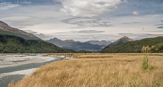
After this unsettled preparation, we finally found ourselves at the Lake Sylvan car-park, kindly dropped there by our friend, his injured shoulder hindering but not preventing driving. Although the weather looked threatening with passing drizzle and strong winds, it gradually improved during the two-hour walk to the Rock Burn Shelter and we arrived there in bright sun. After a gratefully received donation of free lunch leftovers from a party of fun-yakkers, we crossed the Rock Burn and headed up along the Dart River flats, grateful for the flat terrain as we eased ourselves into the routine of extended walking with loaded packs that would continue for the next seven days.
Up ahead we faced the first potential hurdle of our trip – would the recent rains have raised water levels at the Beans Burn crossing where it joins the Dart River? It was a little high, but we forded it without difficulty, and soon found the track that leads up the Beans Burn. This runs initially along the true left bank (the side of the river when looking downstream), but about an hour upstream a bridge across the bottom of a spectacular gorge takes the track to the other side.
From here we had another hour to travel to our first stop, a rock bivvy on the first set of flats in the Beans Burn – easy we thought. Unfortunately, the track sidles high to climb around the gorge, a climb of only 100 m or so, but coming at the end of our first day, we grumbled and complained as we climbed, reaching the bivvy in the later afternoon just as a light drizzle began to fall.
This sleeping in a rock bivvy was a new experience for some of us, and we were glad of the shelter given the rain in the night. Our first day had gone well, our gear had worked with no hassles, and we had eaten well on our first home-dehydrated meal. We even had a super-friendly robin who claimed ownership rights on the place, communicating his clear expectation for food by pecking at our feet as if they might suddenly produce some tasty morsel.
Day Two
Day two dawned to a fine drizzle drifting down the valley on a cool westerly wind, so we packed and headed off early, hoping to reach our destination in the upper Beans Burn before significant rain arrived. In fact, it never did – the day brightened steadily, and while never hot and sunny, our rain gear stayed packed away. The track had clearly suffered recent storm damage, but given its out of the way location, doesn’t seem to be a priority for repair, unlike the nearby tourist highways of the Routeburn! In general we could follow along though, assisted by the notes in the latest Moir’s Guide.
This was a transition day – not notable for any great scenery, although it was always beautiful – one that would take us to the start of the real adventure that would begin the following day with the climb across Fohn Saddle into true West Coast wilderness with its lack of marked routes, demanding a degree of skill and alertness not required for more well-worn tracks.
Eventually we arrived at our goal, but not before an extended wrestle through a section of dense scrub where the track petered out at the upper forest limit. This eventually opened into a walk of a little over a kilometer across grassy flats to the impressive Split-rock Bivvy. This was a grander version of the previous night’s accommodation, with multiple ‘rooms’ allowing for choice of sleeping places. The main snag was the river that was hard over on the western side of its bed, flowing hard up against the bivvy rocks, and requiring the wetting of feet to get either in or out – a ‘room with a moat’ perhaps!
At Split Rock BivvyRegardless of the challenging exit, it was a comfortable place to stay, with room to spread out and sort gear ready for the day ahead. The only draw-back was the mice, heard but rarely seen – determined chewers of any pack pockets in which wrappers or other scraps hinted at the promise of food. Loud were the morning cries of anguish when their damage was discovered!
Days Three & Four
Once we’d reconciled ourselves both to the damage our gear had suffered, and our inability to exact revenge on the little beasts, we set about the day ahead. The odd shaft of sunshine was showing through the almost complete grey overcast, but we set off up the upper Beans Burn, preparing ourselves mentally for the impending 600 m climb up to Fohn Saddle. The initial two kilometers were gentle enough, ascending only 100 m in altitude via a scramble along the bouldery banks of the main river.
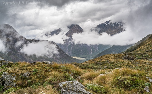
But once directly under the Saddle, the route changed abruptly, taking a savagely direct climb up a steep tussock face, with only the occasional cairn to show that others had also passed this way. Drizzle gradually set in as we climbed, and we entered dense cloud about 100 m below the pass, crossing through the narrow saddle in a chill wind with driving misty rain.
We’d anticipated this as one of the scenic highlights of the trip, but all thoughts of landscape admiration were pushed aside and we headed down-slope in search of drier conditions for a bite of lunch. By the time we’d got to a large right-hand bend in Fohn Stream we were out of the cloud, and we stopped to gratefully down our crackers with pickle and cheese. Assessing the weather, we decided against climbing up to the Fohn Lakes – something we’ve all regretted since – and decided to instead head to our stop for the night, at the rock bivvy on the Olivine Ledge.
We arrived an hour or so later just as the serious rain began, and set about making ourselves comfortable in the fairly restricted space that had remained dry from the prevailing weather – it was damp, but considerably better than the camping options on offer in the soggy tussock outside. Things looked up once we had rigged our tent floor to catch the drips running down the underside of the rock overhang, but there was only just enough dry room for the three of us to spread out our sleeping bags.
The dripping as the rain ran off the rock overhang continued all night, although it had just about stopped when I first looked out at 6.30 in the morning. Emerging from the shelter I saw one of the most threatening grey skies I’ve ever seen in the mountains – streamers of cloud swirling around the peaks from a leaden grey sky indicated that we were in for a wet day. The rain steadily increased in intensity through the morning, and by midday it was clear that we were going nowhere. Previously dry channels on the faces below the Fohn Lakes hissed and foamed as the water released on the upper slopes rushed down-slope – our intended route south towards Fiery Col would have been impassable even if we had wanted to move. This was a day for catching up on back copies of the Guardian, playing cards, yarning and snoozing.
By night fall, the rain had begun to ease, although the amount of dry space in the bivvy had diminished alarmingly to a point where a comfortable night was beginning to look rather hopeful. We retreated to our sleeping bags, careful to avoid the large drips suspended off the roof of our little overhang, fervently hoping that the coming day would bring better weather.
The rest of this trip is described here…
(Please feel free to leave a comment or query)


